|
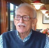
JOHN A. WOLTER (1925 – 2015)
John A. Wolter, former Chief of the Geography and Map Division, Library of Congress, and charter member of the Washington Map Society, died on October 22, 2015.
John prepared the following membership profile for the Spring 2004 issue of The Portolan:
JOHN A. WOLTER: Cartographic Interests: 19th century Great Lakes and Western U.S., nautical charts and atlases, Socotra Island and the Horn of Africa. Professional Background: Received a bachelor's degree in geography (1956), a master's in library science (1965), and a Ph.D in geography (1975), all from the University of Minnesota. At Minnesota (1960-66) served respectively as map librarian, assistant to the director of libraries, and as lecturer in the Geography Department In addition, as an assistant professor, taught geography at the University of Wisconsin River Falls for two years (1966-68) prior to beginning my career at the Library of Congress. Served in the Merchant Marine during World War II (1943-1945). During the late ‘40s and early and late '50s I was a deck officer with Isthmian Steamship Co., voyaging on passenger/cargo vessels to ports in the Red Sea, Persian Gulf. India. Ceylon, Indochina and Indonesia, and from New York west bound “round the world.” During the Korean War, (1950-52), served in the U.S. Army stationed in the Far East. Comments: My fascination with maps dates back to my childhood days. As a youngster I collected railroad timetables and route maps. During my sea-faring years as navigating officer and cargo officer, I used, and made additions and corrections to a variety of navigational charts and maps. While map librarian at the University of Minnesota, I participated in several Library of Congress Geography & Map Division map processing projects and became familiar with the varied cartographic collections. Staff members were always willing to help and instruct us and we all appreciated their expertise and concern. In 1968, while teaching at the University of Wisconsin-River Falls, I applied for, and after being interviewed by much of the Library hierarchy, was appointed assistant chief of the LC’s G&M division. In 1978 I succeeded Wally Ristow as division chief. We had discussed forming a map society for some time and in 1979 Ralph Ehrenberg, Dick Stephenson, Wally, John Lanman, Jeanne Young, Ron Grim, Andy Modelski and I began what has grown into a strong and vibrant group of map aficionados. Wally became the first president and CEO and did much to assure the society's growth. We moved the division from Pickett Street in Alexandria to the Madison Building in. 1980 and were the first special collections division m the building. We took advantage of all the fanfare surrounding our arrival. National and local television, radio, magazines, and newspapers gave us wonderful coverage. Maps, charts and atlases arc most photogenic, thus we became a "flagship division" for the Library. All this publicity attracted new members and helped the society to grow. In addition, we were able to convince Library officials that meeting in the division would be advantageous to both the division and the Library. I gave two or three lectures during the early years and arranged for several others by visiting scholars and others to coincide with exhibit openings and professional meetings. I retired from the Library of Congress in 1991 after serving as acting director for public service and collections management. Since retirement I have been able to stay active by giving an occasional lecture and continuing my research in libraries, archives and in the field. Recent publications include: The Napoleonic War in the Dutch Indies: An Essay and Cartobibliography of the Minto Collection (Washington, D.C., Library of Congress, 1999); with Ron Grim, Images of the World: The Atlas Through History (Washington, D.C., Library of Congress: New York, McGraw-Hill, 1996), and Progress of Discovery: Johann Georg Kohl auf den Spuren der Entdecker (Graz. Austria, Akademische Druck-und Verlaganstalt, 1993).
|