|

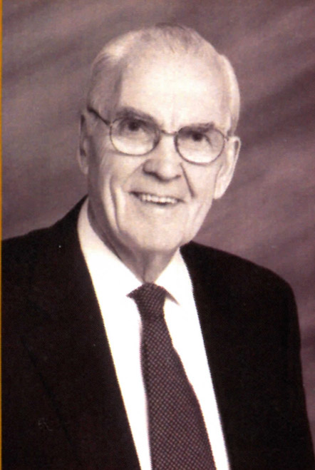
ALAN M. VOORHEES, 1922-2005
A Dual Remembrance
By Marianne McKee and Gary Fitzpatrick
On December 18, 2005, the map community lost a very good friend, Alan M. Voorhees. After an enjoyable Christmas celebration at the Berkeley Hotel in Richmond, Virginia, with business staff and family, and at the same time celebrating his 83rd birthday (December 17), he collapsed and died. Al was an extraordinary urban planner and transportation consultant, but he also began collecting maps in the 1970s. He was a member of the Washington Map Society for over fifteen years and on its Board of Directors from 1993 to 1995.
I first met Al in 1992 when I was program chair and vice president of the Washington Map Society and looking for a base hotel for a field trip to Richmond. A colleague mentioned the Berkeley Hotel, filled with maps and just down the street from the Library of Virginia where I worked as the map specialist and a research archivist. Hearing of my interest in the hotel, and why, and delighted to work with a group dedicated to maps and geography, Al called me and offered to help plan the event. We all had a wonderful time during that April weekend, opening up Richmond’s cartographic treasures and repositories. Al met many Washington Map Society members, including Ralph Ehrenberg, then chief of the Geography and Map Division at the Library of Congress, and therein began a close relationship between Al and the Library of Congress and library connections in Richmond.
One of Al’s best attributes was his enthusiasm and delight. He loved to point out his Alexandria home on the 1863 Magnus view of Alexandria. Or explain his work in the Navy through maps he had made during World War II as a member of the Underwater Demolition Team. In June 1995, he and his wife, Nat, invited the Washington Map Society down to their home in Westmoreland County, next to the Westmoreland Berry Farm, one of his many enterprises. In 1994, Al had given 729 acres of this land along the Rappahannock to the Nature Conservancy. He had seen the development around other Washington area rivers, and wanted to preserve this pristine area for nature and environmental education. And he loved his eagles, which we were alerted to on boat trips down the river throughout the afternoon. We viewed rare maps and atlases inside the lovely house he had built for his wife, we enjoyed seeing the results of her skill at needlework, and we had a good lunch and good wine.
Getting a telephone call from Al always opened up something new and exciting, and it certainly made my work more interesting. He followed the construction of the new library building (opened in early 1997) and had a hard hat tour. He was a strong supporter of the spring 1999 Virginia In Maps Project – a major exhibit of Virginia maps, a symposium, and an atlas (Virginia in Maps: Four Hundred Years of Settlement, Growth, and Development, edited by Richard W. Stephenson and myself), the latter published in 2000. The project was funded largely by a challenge grant to which the map community responded generously, but none as greatly as Al and his family, and the book is dedicated to him and his wife. He also took an active role in planning the afternoon part of the symposium – examples of the use of older maps with modern technologies -- and he provided support for the digitization of land records. Al and his wife received the 2000 Philanthropic Award from the Library of Virginia Foundation, and the reading room housing and referencing the Library’s map collection was named in honor of his wife, Nathalie. And he was instrumental in initiating the recently completed Civil War Maps Project, a cooperative project with the Library of Congress, Library of Virginia, and Virginia Historical Society to catalog and digitize their Civil War maps and mount the images on the Library of Congress’s American Memory website.
In the last few years, gifting repositories became a special interest of his. When he decided to dispose of his superb collection of over 200 maps, he divided them primarily between the Library of Congress, the Library of Virginia, and the Virginia Historical Society, another Richmond repository that had been on the receiving end of his generosity. Al had been a trustee of the Society since 1996, a regional vice chairman, and had provided the necessary support to automate and manage the Society’s collections of books, documents, and maps.
The Library of Virginia thanked this most generous friend by mounting an exhibit of all the rare and historic maps and atlases received. It was breathtaking, and the Chesapeake Bay, his primary interest, stood out in almost all of these lovely images. The annual Alan M. and Nathalie P. Voorhees Lecture in the History of Cartography was also established in his honor by the Library of Virginia Foundation, and the first lecture in the spring of 2004 was given by Dr. Mary Sponberg Pedley, Assistant Curator of Maps for the Clements Library at the University of Michigan. Speaking on the role of collectors and their importance to repositories, she noted that their “collections awaken and arouse interests that spur additional growth and further research and more collections.” His generosity has done exactly that.
Al enjoyed being with people, finding better ways of doing things, and providing resources for good ideas. His impressive and productive life was celebrated in a memorial service on January 18, 2006, followed by a reception at the Congressional Country Club. He would have enjoyed it.
Marianne McKee, a former President of the Washington Map Society, worked with the Map Collection at the Archives of the Library of Virginia from 1982 to 2004.
Al Voorhees first began working with the Library of Congress in 1993 when he volunteered to lead the Geography and Map Division in the creation of a corporate group to assist in the transition to the digital era of geography and cartography. Al did not take such duties lightly. He was constantly coming up with ideas, making recommendations on who to bring into the group and arranging meetings with prospective partners. Under Al's leadership, nearly $800,000 worth of equipment and software was donated to the Division from a variety of companies. The first and most lasting accomplishment was the creation of the scanning program that now constitutes the cartographic component of the Library's American Memory program.
During the last ten years of his life, Al donated numerous rare historic maps to the Geography and Map Division, often asking only to receive back a print made from a digital scan that could then be placed in the old frame. At his Alexandria home, in his office, and on the walls of the Berkeley Hotel were many frames holding those digital prints, reminders to those who knew him of Al's generosity.
Among Al's significant contributions to the Library were maps he compiled during his World War II service in an Underwater Demolition Team, the precursor of the elite Seals of the modern day Navy. One of those was a map of Nagasaki Harbor. Approximately two weeks after the atomic bomb was dropped there, Al's unit surveyed the harbor for mines to ensure that the U.S. fleet could enter. He then went ashore and was among the first outsiders to see the devastation. His unit specialized in destroying enemy defensive obstructions, and for the three months before the end of the war they trained to lead the American invasion of Japan itself. Al was one of the few people who knew where the invasion was to take place.
Al distinguished himself as both a professional engineer and businessman, with the transportation design of Washington's Metro his most well known work. He was instrumental in planning the Interstate Highway System and designing major mass transit systems in the United States and abroad. He was particularly successful as an angel investor -- identifying people with good ideas and helping them get their businesses up and running. In that capacity he founded an airline and backed early pioneers in electronic cash registers and bar coding technology. Geography was one of the fields in which he was active as an investor, playing major roles in firms that focused on satellite imagery for the intelligence community, the rebuilding of cadastral systems in former Soviet Union Companies, aerial photography, and web delivery of scanned images.
During the 100th anniversary of the Geography and Map Division, Al participated in the "Meet the Cartographers" panel with Arthur Robinson, Hal Shelton, and Marie Tharp. Though not a cartographer, Al displayed an exceptionally deep grasp of the wide-ranging significance of the modern geographic technologies. He responded to one question about these technologies by saying, "they contribute to good government." For many years, Al was a member of the state-wide GIS coordinating committee for Virginia.
As a celebrant said at Al's memorial service, no matter how well you knew him you really had no grasp of all the different businesses, organizations, and activities he was involved in. It is impossible to identify the many beneficiaries or the magnitude of his philanthropy. His mind was constantly active, and he was not stuck in the past in any way. At a G&M Christmas party shortly after his 81st birthday, he provided an instructive lecture to several party-goers about why wireless broadband access was the next big thing. Had Al lived to be a hundred, he would probably have been working and investing to the very end.
Gary L. Fitzpatrick, a former President of the Washington Map Society, is retired from the
Geography and Map Division of the Library of Congress.
|